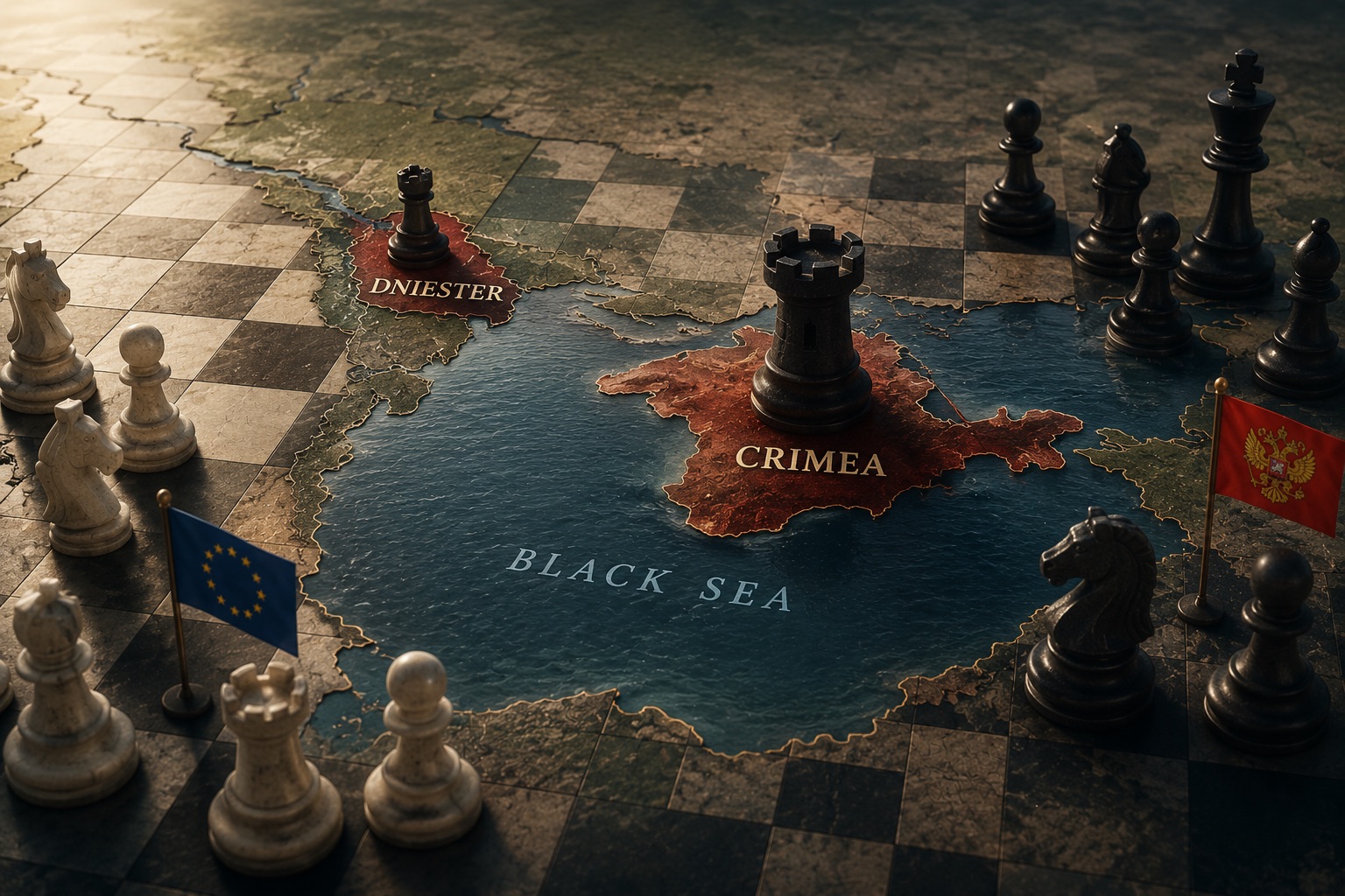
Crimea and the Dniester Region: A Single Historical System
This is part I of four-part series on historical perspectives on Crimea and the Dniester. What 2,500 years of evidence tells us about combined deprivation.
|
The argument
This article — the first part of a four-part series — examines what 2,500 years of historical evidence tells us about Crimea and the Dniester (Transnistria) region. The scope of the examination is through the lens of these territories recent history role and position as the occupied territories. The constructed historical dataset comprises sixteen periods: seven developmental, eight military-establishment, and one mixed (the Crimean Khanate). Across this evidence, four structural findings emerge: trade-node identity is the territories' natural function, geographically determined and reproduced under every governance model that permitted it; alliance embedding within a broader framework is the prerequisite for survival under persistent imperial pressure; the two territories operate as a single, geographically contiguous system, closely adjacent geographic system whose three-node architecture (Crimean maritime + Dniester right-bank transit + left-bank production) reproduces itself whenever conditions allow; and the asymmetry between centuries-long construction and weeks-long destruction makes prevention orders of magnitude more cost-effective than restoration. Parts II, III and IV of this four-paper series will translate these findings into scenarios and policy. This first part establishes the historical baseline.
The structure follows the evidence. Section one presents the combined chart — sixteen periods on a single timeline — and the visual patterns it reveals. Section two examines each major era through schematic maps and analytical text drawn from the historical annexes. Sections three through six deepen the analysis: the joint examination of synergy and complementarity, the mechanics of transformation between developmental and military phases, six conclusions across the periods, and a final synthesis. The four-paper series represents a concise version of the research aimed at provoking the debate.
1. The Combined Historical Chart
The chart on this page integrates the dataset into a single timeline. Each region — Crimea above, Dniester below — has two parallel bands. The upper band of each pair shows developmental periods (green); the lower shows military establishment periods (red). A central joint band records the moments at which the two territories operated under a unified framework, whether developmental (blue, e.g. Pax Mongolica, the three-node peak) or military-coordinative (muted dark pink, e.g. Ottoman sequential elimination, Imperial naval-army integration, Soviet unified command, modern distributed pressure nodes).
The horizontal scale is piecewise-linear: the ancient era (500 BCE–1100 CE) is compressed; the modern era (1700–2026) is expanded. This deliberate non-uniformity makes both the 900-year vacuum and the dense modern sequence visible at the same scale. Reading the chart from left to right, sixteen periods can be enumerated: seven green developmental periods, eight red military-establishment periods, and one amber period (the Crimean Khanate, 1441–1783) that uniquely sits in both bands because its productive economy genuinely coexisted with — but was capped by — its slave-raiding extractive base. Across 2,500 years and sixteen periods, the Crimea–Dniester geography has operated under exactly two economic regimes, and the contrast is almost arithmetically clean. Under the three-node developmental model — Genoese Kaffa as Crimean maritime gateway, Moldovan Tighina (Ottoman renamed Bender) as Dniester right-bank transit, and the Polish-Lithuanian Commonwealth (PLC) left-bank production hub, knitted first under the Pax Mongolica and then under early-modern European commerce — the region became one of medieval Eurasia's densest commercial complexes, with Kaffa at 70,000–80,000 inhabitants comparable to Genoa itself. Under the garrison-extractive alternative — Ottoman closure, Russian Imperial absorption, Soviet militarization, and post-2014 occupation — the same geography functioned as forward military outposts requiring net fiscal transfers, suppressing local commerce, and imposing costs on neighbors: the modern equivalents being the €1.1–3.5B/yr Crimean offshore-wind suppression, the €3–7B/yr multi-vector suppression premium, and Transnistria's DCFTA parasitism. The three-node model is structurally positive-sum; the garrison model is structurally negative-sum. Across 2,500 years, the binary holds without exception — making the modern choice between Russian garrison continuity and combined deprivation an empirical, not normative, question.

Figure 1. Combined Historical Chart — Crimea and the Dniester: 2,500 Years of Developmental vs. Military Function. Seven developmental periods (green), eight military-establishment periods (red), one mixed (Khanate, amber). Joint band shows moments of unified framework (blue = developmental, dark pink = military-coordinative).
Eight findings the chart reveals
1. The Bosporan isolation. The Bosporan Kingdom (far left, dark green) stands alone with a 900-year gap before the next developmental period. No other period — green or red — is separated from its neighbours by such a void. The Hunnic destruction of the 4th–5th century did not merely end a developmental period; it created a nearly millennium-long civilisational vacuum. This is the worst-case baseline: military destruction in years, recovery in nearly a millennium without active institutional intervention.
2. The fifteenth-century pivot. The most analytically dense zone of the chart is the late fifteenth century, where green blocks (Genoese Kaffa, Moldovan Principality, emerging PLC) give way to red ones (Ottoman Kefe, Ottoman Bender). The three-node peak (Kaffa + Tighina + PLC/Bratslav, late 14th–mid 15th c.) collapses through sequential node elimination over 63 years (1475–1538). The PLC green bar then extends 255 years beyond Ottoman seizure of the right bank — visible evidence that alliance embedding produces institutional resilience that isolated Moldavia lacked.
3. The Khanate dual identity. The Crimean Khanate (1441–1783) is the only period that appears in both the developmental and military bands of Crimea — amber in the developmental row (productive agriculture, cultural institutions), dark sienna in the joint band (slave raiding, ~2–3 million captives over 342 years, regional destabilisation). This dual representation is the chart's encoding of the extractive-ceiling thesis: the Khanate's productive capacity was real, but its extractive dimension permanently capped its developmental potential. The same dual identity now characterizes Transnistria, where roughly €1 billion of legitimate EU trade coexists with a Russian-affiliated exploitation system.
4. The acceleration of military establishments. Reading the Crimean military band left-to-right reveals a striking pattern: the red blocks become shorter in duration but more intense in mechanism. The Ottoman garrison lasted 308 years through a single mechanism (trade closure). The Imperial period lasted 134 years through two mechanisms (garrison economy + demographic displacement). The Soviet period lasted 71 years through four mechanisms (deportation, closed-city status, military-industrial reorganization, ideological erasure). The modern occupation has lasted twelve years but deployed immediate A2/AD plus the novel four-node distributed pressure architecture. Each successive red block is narrower in time but broader in destructive scope.
5. The Ukrainian sovereignty sliver. At the far right of Crimea's developmental band, the light-green block representing Ukrainian sovereignty (1991–2014) is strikingly thin — 23 years — immediately adjacent to the dark-red block of Russian occupation. The visual contrast dramatizes the speed asymmetry: the only modern democratic developmental precedent for Crimea, erased in weeks of military conversion. Twenty-three years of patient construction, weeks of destruction.
6. The PLC bar as longest Dniester governance. In the Dniester developmental band, the PLC bar (dark green, 15th c.–1793) is visually the widest single developmental block at roughly 300 years. It is also wider than the cumulative Russian Imperial bar in the military band below it (~230 years counting from 1793 to the present, across Imperial, Soviet, and post-Soviet forms). European-type governance — the PLC framework — has deeper historical roots in this territory than the Russian military model. EU integration is restoration, not imposition.
7. Bender's 488-year militarization. Tracing horizontally across the Dniester military band from the Ottoman fortress establishment (1538) through every subsequent red block to the present, the viewer sees unbroken military function spanning 488 years at the Bender/Tighina site. No other location in either territory shows comparable continuity. The commercial function established when Tighina was a Moldovan customs post (documented 1408) has never been restored — the longest uninterrupted militarization in the dataset.
8. The coordination escalation. The joint band along the center of the chart traces a 550-year escalation: Ottoman sequential elimination → Imperial naval-army integration → Soviet unified command → post-Soviet distributed pressure nodes (DPN). Each phase achieves more sophisticated coordination than its predecessor. The current four-node system[1] (Crimea + Transnistria + Kaliningrad + Belarus) has no historical precedent in geographic scope. Partial deprivation triggers compensatory escalation through remaining nodes — which is why the historical record makes combined deprivation operationally necessary, not merely strategically preferable.
2. Period-by-Period: The Four Eras
The sixteen historical periods cluster naturally into four eras, each with its own analytical center of gravity. Era 1 covers the Bosporan Kingdom and the catastrophic 900-year vacuum that followed its destruction — establishing the worst-case recovery baseline. Era 2 covers the Pax Mongolica, the Genoese-Moldavian-PLC three-node peak, and the mixed Crimean Khanate — the period of maximum complementarity under unified frameworks. Era 3 covers the Ottoman closure and Russian Imperial establishment — the 350-year sequential destruction of the three-node system. Era 4 covers the Soviet period, the 23-year Ukrainian developmental window for Crimea, the frozen Transnistrian conflict, and the modern Russian re-occupation with its novel mechanisms.

Figure 2. Era 1. The Bosporan Kingdom (eastern Crimea + Tyras at Dniester mouth) under Roman alliance, supplying ≈21,000 t/yr of grain to Athens. Hunnic destruction (4th–5th c.) → 900-yr vacuum until Genoese Kaffa (1266).
Peak achievement. The Bosporan Kingdom occupied the Kerch Strait and eastern Crimea for approximately a thousand years — the single longest developmental period for either territory in the dataset. According to Demosthenes, Athens imported around 400,000 medimnoi (~21,000 metric tons) of grain annually from the Bosporus, perhaps half its total supply. The kingdom maintained its own coinage, multicultural governance (archons to Greeks, kings to non-Greeks), and a Roman client-state framework that supplied security as a public good. The Greek colony of Tyras at the Dniester mouth funneled hinterland goods (grain, hides, furs, honey) into the same maritime network — the earliest evidence of the two-territory complementarity that every subsequent developmental period would reproduce.
Destruction and vacuum. The Hunnic invasions of the 4th–5th centuries CE annihilated the system in a matter of years. Crucially, the Huns did not establish military-primary governance — they simply destroyed and left nothing. The result was a 900-year developmental vacuum: no successor state, no commercial infrastructure, no developmental governance until the Genoese established Kaffa under the Pax Mongolica security framework in 1266. The vacuum is the worst-case baseline of the dataset: it demonstrates that without active institutional intervention, recovery does not occur organically; the territory simply remains undeveloped for centuries.
Modern equivalent. Bosporan grain trade maps to Ukraine's modern grain corridor and DCFTA market access. The Bosporan-Roman client-state framework maps to NATO embedding. Multicultural governance — archons and kings, Greeks and non-Greeks — maps to autonomous status within a broader European institutional framework. The 900-year vacuum is the timeline that organic recovery defaults to: institutional intervention exists precisely to compress it to years rather than centuries.

Figure 3. Era 2. Three-node developmental peak: Genoese Kaffa (Crimean maritime) + Moldavian Tighina (Dniester right-bank transit) + PLC Bratslav (left-bank production), under Pax Mongolica security framework. The Crimean Khanate (1441–) is mixed — productive agriculture capped by slave raiding.
Peak achievement. Era 2 is the period of maximum efficiency in the entire 2,500-year dataset. The Pax Mongolica (1240–1350) was the first historical framework spanning both Crimea and the Dniester simultaneously: Yam postal network, caravan protection, minimal trade taxes, passport system. Under this framework, three complementary nodes emerged: Genoese Kaffa (population ~80,000, described by Ibn Battuta as one of the world's most celebrated ports, Silk Road's European terminus with banking, credit, insurance, and multicurrency exchange systems); Moldovan Tighina (Lviv–Black Sea customs post, generating the revenues that funded Stephen the Great's 40+ churches); and PLC (chernozem-belt production with Magdeburg Rights, religious tolerance, and Baltic-to-Black Sea connectivity). The three nodes operating in concert produced the highest-efficiency commercial system the region has ever seen.
The mixed Khanate. From 1441 the Crimean Khanate emerged as an Ottoman vassal that uniquely combined productive function (grain, wine, salt, horses) with extractive function (slave raiding into the PLC and Muscovy, with cumulative captives estimated at 2–3 million over 342 years). The Khanate is the dataset's only genuinely mixed case — and it validates the extractive-ceiling thesis: productive agriculture was real, but slave raiding's regional destabilization prevented stable commercial relations and capped what the territory could become. The same dynamic — productive activity capped by an extractive ceiling enforced through external military presence — characterizes modern Transnistria.
Destruction. Pax Mongolica fragmented within a century, but the three-node system survived another hundred-and-twenty years on Genoese-Moldovan-PLC institutional substitutes. Then, in 63 years (1475–1538), the Ottomans destroyed it sequentially: Kaffa fell in 1475, Cetatea Albă in 1484, Tighina in 1538. Two empires (Ottoman, then Russian) and 350 years of sequential conquest were required to fully eliminate the system. The PLC's left bank survived 255 years longer than the Ottoman-conquered right bank — a direct measurement of what alliance embedding produces.
Modern equivalent. Pax Mongolica maps to NATO/EU as the modern unified continental framework — but with treaty-based institutional durability the Golden Horde lacked. The three-node system maps to: Crimea as Middle Corridor maritime hub + grain corridor; right-bank Moldova as 3SI transit corridor; Transnistria as EU-integrated agricultural and industrial production zone. Combined deprivation of both Crimea and Transnistria would, for the first time since the fifteenth century, recreate the conditions for this complementarity.

Figure 4. Era 3. The Black Sea closed for 300 years to non-Ottoman shipping (1475–1774). Sequential node elimination: Kaffa 1475 → Cetatea Albă 1484 → Tighina 1538. Russian annexation (Crimea 1783, left bank 1793, right bank 1812) replaced one military regime with another — regime change without model change.
Ottoman military establishment (1475–1783). 308 years of systematic garrison conversion and trade closure. The defining mechanism was the Black Sea's closure to non-Ottoman shipping for 300 years (1475–1774) — the "Ottoman Lake." The Ottomans did not merely conquer territories; they eliminated the commercial system that gave them value. Kaffa, the most sophisticated port in the Black Sea, dropped from 80,000 inhabitants under Genoese control to a fraction under Ottoman Kefe administration. Banking, credit, and insurance institutions were rendered valueless. Continental Europe lost its direct access to the Silk Road, contributing to the economic pressures that drove the Age of Exploration. Tighina (renamed Bender by Ottomans) began the longest uninterrupted militarization in the dataset — 488 years and counting, through Ottoman, Russian Imperial, Soviet, and post-Soviet regimes.
Russian Imperial establishment (1783–1917). 134 years of what the analysis terms regime change without model change. Catherine the Great's 1783 annexation replaced the Ottoman military system with a Russian military system rather than restoring developmental function. Sevastopol was established as the Black Sea Fleet's home port — Catherine's "Greek Project" measured Crimea's value in strategic projection toward Constantinople, not developmental potential. The Crimean Tatars were progressively marginalized from majority to minority through waves of emigration and displacement, with Russian and Ukrainian settlers brought in primarily to serve military infrastructure. The 1853–56 Crimean War devastated Sevastopol in a 349-day siege precisely because its military function made it a strategic target — the garrison-identity trap. Feodosia (formerly Kaffa) stagnated for 111 years (1783–1894) and only recovered commercially through new harbor works in 1894 — 419 years total recovery time, and only via active infrastructure investment.
The PLC's destruction (1793). The Polish-Lithuanian Commonwealth (PLC) was abolished entirely through the Second and Third Partitions. Its sophisticated institutional framework — sejmiks, Magdeburg Rights, religious tolerance, Council of Four Lands — was replaced with Russian provincial administration directed from St. Petersburg. The PLC Bratslav Voivodeship's 300-year governance tradition was erased in favor of a garrison zone. Bender, Tiraspol (founded 1792), and the Cobasna ammunition depot site began their continuous militarization under Russian sponsorship.
Modern equivalent. Ottoman closure maps to Russian A2/AD: same mechanism (denying maritime access), different technology (cannons then; S-400 and Bastion missiles now), same continental cost imposed on every littoral state. Sequential node elimination maps to today's Russian node-seizure approach: controlling junction points (Tiraspol, Bender, Cobasna) rather than conquering whole territories. Regime change without model change is the precedent for any future arrangement that merely transfers sovereignty without replacing the organizing principle — the historical record permits no exceptions to the rule that this fails.

Figure 5. Era 4. Crimea 1991–2014 (no Russian troops): 23 years of developmental governance — the only modern democratic precedent. Transnistria 1992– (with Russian troops): zero years of development. The contrast is the direct cost measurement of Russian military presence.
Soviet military-industrial establishment (1920/1924–1991). Crimea: 1944 Crimean Tatar deportation (~200,000 people, ~46% mortality) destroyed not merely a population but a knowledge system — centuries of agricultural expertise, commercial networks, cultural institutions. Soviet settler colonialism created populations whose identity was mediated through the military-administrative system, providing the engineered demographic base later exploited for the 2014 "referendum." Sevastopol became a closed military city. Dniester: the soviet created MASSR (Moldavian ASSR) was created in 1924 explicitly as a political platform for Soviet claims on Bessarabia, with no developmental rationale — its institutional DNA (security services, command-economy structures, separatist political identity) persists in the modern Transnistrian entity 102 years later.
The Ukrainian developmental window (1991–2014). Twenty-three years of imperfect but real developmental governance under Ukrainian sovereignty over Crimea. Tourism, agriculture, services, EU Association pathway — the only modern democratic developmental precedent in the dataset. The Russian naval base lease at Sevastopol constrained development by deterring foreign direct investment, but partial development was achieved. This is the single natural-experiment data point that quantifies the cost of Russian military presence: Crimea (no Russian troops, mostly): 23 years of developmental governance. Transnistria (re-occupied by proxy by Russia with the Russian troops continuously since 1992)[2]: zero years of development. Same post-Soviet transition period, same structural starting conditions; the controlled difference is military presence.
Russian re-occupation (2014–present) and novel mechanisms. The 2014 seizure took weeks — the fastest establishment in the entire 2,500-year dataset. A2/AD denial zones, distributed pressure nodes, sanctions isolation, water crisis, infrastructure decay, abolition of democratic governance. Two mechanisms in this period have no historical precedent. First, weaponized economic interdependence ("DCFTA parasitism"): Russian oligarch-controlled enterprises in Transnistria exploit EU trade preferences, using Russian gas subsidies to undercut prices, channeling profits to maintain the military occupation that prevents reform. EU consumers unknowingly fund Russian military capabilities through normal commercial purchases. Second, distributed pressure nodes: a four-node synchronized system (Crimea + Transnistria + Kaliningrad + Belarus) that exceeds any historical coordination in geographic scope, creating an "impossible resource allocation challenge" for NATO. Partial deprivation of any one node triggers compensatory escalation through the others — making combined deprivation operationally necessary, not merely strategically preferable.
The Naval-Maritime Validation
The same sixteen-period dataset can be re-projected onto the maritime axis — Black Sea access, riverine connectivity, and strait control — and produces an independent confirmation of the developmental–military binary. The chart below maps seven maritime-commercial periods (green) and seven naval-military periods (red) across Crimea and the Dniester, with a continuous strait-control band (blue) recording who held the Bosphorus chokepoint at each moment. Whoever controls the straits determines who can enter the Black Sea; whoever controls the Dniester corridor determines whether the landlocked hinterland can reach maritime trade at all. The two coordinates — sea and river — are not independent but coupled, and the chart shows how every period of regional prosperity required both to be open simultaneously.

Figure 6. Naval-Maritime Complementarity Chart — Crimea and the Dniester: 2,600 Years of Maritime Trade vs. Naval-Military Garrison. Seven maritime-commercial periods (green), seven naval-military periods (red), strait-control band (blue). Synchronised with the Combined Historical Chart (Figure 1).
Three implications follow. First, strait control is permanent; naval hegemony is temporary — and the temporary windows are getting shorter. Byzantine Black Sea dominance lasted ~800 years, Ottoman 299, Russian Imperial 134, Soviet 71, and post-2014 Russian re-establishment broke after just 8 years under Ukrainian USV-and-missile pressure. Each successive naval hegemony was structurally shorter than the one before it — the inverse of the speed-of-destruction acceleration documented in the land chart. The Montreux Convention (1936–present) institutionalizes the geographic permanence: with Turkey enforcing strait closure since February 2022, the Russian Black Sea Fleet has become a depleting asset, unable to be reinforced, while continuing to absorb attrition. This is a structural shift without precedent since the 1856 Treaty of Paris.
Second, maritime and riverine deprivation are coupled, not separable. The Ottoman closure of 1475–1774 worked precisely because it shut both axes simultaneously: Caffa fell in 1475 (maritime), Cetatea Albă in 1484 (estuarine), Tighina in 1538 (riverine). Closing only one would have left the other as an alternative route. The modern Russian system reproduces the same architecture: the BSF and A2/AD bubble close the maritime axis from Crimea, while the OGRF garrison and frozen conflict close the Dniester corridor from Transnistria. Moldova’s 600 meters of Danube frontage at Giurgiulești is the single fragile workaround — insufficient to substitute for full riverine and maritime restoration. Combined deprivation of Crimea and Transnistria is the maritime equivalent of restoring the three-node land system: not preference, but the geographic minimum for a functioning corridor.
Third, Crimea’s natural maritime function is commercial, not military. The maritime chart shows roughly 1,100 years of commercial-maritime function (Bosporan + Genoese + Ukrainian sovereignty) against ~540 years of military-naval function (Ottoman + Imperial + Soviet + post-2014). The Odesa–Sevastopol divergence since 1794 demonstrates the binary on a single coastline: Odesa’s commercial growth occurred precisely because Sevastopol absorbed the military function. The two cities are physically separable but institutionally incompatible — the same logic identified in the land chart for Tighina (military) versus the right bank’s lost commercial corridor. Ukrainian USV warfare since 2022 is not an aberration but a return to the Bosporan model: maritime power deployed in service of trade protection rather than territorial aggression. The naval-maritime evidence does not add a separate finding; it confirms, on an independent axis, that the developmental–military binary, the speed asymmetry, the coupled-deprivation logic, and the alliance-framework requirement all operate identically at sea as on land.
3. Joint Examination — Synergy and Complementarity
The two analytical tracks (developmental and military) function as deliberate mirror images. For every positive lesson, the negative track provides the inverse cautionary precedent. This mirror-image architecture is not merely organizational — it reflects a substantive analytical claim: development and militarization are not two points on a spectrum but two fundamentally incompatible organizing principles for a territory. No stable equilibrium exists between them; each territory always gravitates toward one or the other.
Positive Lesson (Developmental) | Negative Mirror (Military) | Joint Implication |
Trade-node identity is the natural developmental function | Military conversion destroys centuries of commercial capital in weeks | Development is the default; militarisation requires active destruction. Restoration is therefore a return to natural function, not the imposition of new order. |
Alliance frameworks enable development | External security dependency without developmental autonomy produces terminal vulnerability | Alliance embedding is necessary but not sufficient. Must be paired with developmental autonomy. NATO without EU = garrison; EU without NATO = vulnerability. |
Crimea and Dniester form complementary parts of a single system | Coordinated military use multiplies threat beyond sum of parts | Complementarity works in both directions. Combined development maximises benefit; combined militarisation maximises threat. Partial solutions yield asymmetric outcomes far below potential. |
European integration correlates with development across ALL periods | Closed-sea/closed-border regimes impose costs far beyond controlled territory | Openness and closure are continent-scale phenomena. EU integration benefits all neighbours; Russian closure costs all neighbours. The externality structure makes this a European, not merely regional, challenge. |
Extractive elements limit developmental potential | Military-extractive and productive activities cannot coexist sustainably | Half-measures always fail. No arrangement preserving any extractive element has produced sustainable development across the entire dataset (2,500 years, 16 periods). Complete elimination is the only historically validated approach. |
Table 1. The mirror-image architecture: each developmental finding has a precise negative counterpart, and the joint reading produces the operational implication.
Synergistic findings
The developmental–military binary is absolute, not gradual. Every period in the dataset falls clearly into one category. The Crimean Khanate — the only candidate for a "mixed" classification — is treated as developmental in the positive analysis (acknowledging genuine agricultural and cultural productivity) but as an extractive-military establishment in the negative analysis (slave raiding as the organizing principle). The joint reading confirms the negative classification: the Khanate's productive capacity was always constrained by its extractive ceiling. There is no precedent for a stable middle position.
Recovery requires institutional intervention proportional to damage depth. Developmental periods generated cumulative institutional capital — commercial law, financial systems, multicultural governance. Military establishment destroyed this capital comprehensively. The joint implication: post-deprivation recovery must rebuild institutional capital actively. The EU/3SI/Middle Corridor frameworks are not desirable but necessary, because organic recovery takes centuries (Feodosia: 111–419 years; the Bosporan vacuum: 900 years) while institutional recovery can be compressed to years.
The coordination logic applies symmetrically. Three-node complementarity is the system's peak development architecture. Coordinated military exploitation is the system's peak threat architecture. The same geographic structure that enables maximum development also enables maximum threat. Partial deprivation leaves the coordination mechanism intact and triggers compensatory escalation through the remaining node. This is the operational basis of the combined-deprivation argument: not preference, but necessity.
4. Transformation Mechanics — What Triggered Transitions
The sixteen periods are not static states but points in a dynamic system that repeatedly shifted between developmental and military organizing principles. Understanding the specific mechanisms that triggered each transition is essential for anticipating and shaping future ones. The dataset divides into two transition types: destructions (developmental → military, five major instances) and restorations (military → developmental, four major instances).
4.1 Destructions: developmental → military
Transition | Date | Trigger | Speed | Recovery |
Bosporan → Hunnic vacuum | 4th–5th c. CE | External military force exceeding alliance (Roman) capacity | Years (gradual decline then collapse) | ~900-yr gap before Genoese era |
Genoese Kaffa → Ottoman Kefe | 1475 | Ottoman strategic decision: trade closure + garrison conversion | Weeks (single campaign) | 419 yrs (1475–1894). Financial systems never replicated |
Moldavian right bank → Ottoman fortress | 1484–1538 | Sequential node seizure (Cetatea Albă, then Tighina) | 63-yr sequential process | 488 yrs continuous; commercial function NEVER restored |
PLC → Russian Imperial garrison | 1793 | Second Partition of Poland; external destruction of PLC framework | Immediate (treaty-based) | ~230 yrs Russian control and counting |
Ukrainian Crimea → Russian occupation | 2014 | Russian strategic decision ("little green men" + staged referendum) | Weeks. Fastest establishment in dataset | 12+ yrs ongoing; historical parallels: 111–419 yrs without intervention |
The pattern. Imperial strategic decision is always the trigger. No developmental period ended through internal decay alone; an external imperial actor always made a deliberate decision that military control served its objectives better than the territory's developmental function served regional prosperity. Alliance framework failure is the universal enabling condition: every developmental territory's security framework proved insufficient against the imperial threat. And the speed of destruction has accelerated across periods — Bosporan decline took decades, Ottoman sequential conquest 63 years, Russian absorption was treaty-immediate, the 2014 Crimea seizure took weeks. This acceleration reflects both improving military technology and the institutional momentum bequeathed by previous establishments.
4.2 Restorations: military → developmental
Transition | Date | Enabling mechanism | Duration & critical factors |
Hunnic vacuum → Pax Mongolica/Genoese | ~1240–1266 | Mongol conquest paradoxically created continental security framework enabling Genoese colonization | ~900 yrs of vacuum before recovery; Genoese commercial sophistication was active external intervention |
Pax Mongolica fragmentation → Moldavian Principality | ~1350–1359 | Golden Horde fragmentation created vacuum; Moldavia formalized the corridor Pax Mongolica had established | ~10–20 yrs because trade-route infrastructure survived regime change |
Ottoman/Khanate → Russian Imperial (partial) | 1783–1894 | Annexation replaced one military regime with another; commercial recovery only via 1894 harbor works | 111 yrs from annexation to recovery. Regime change WITHOUT model change = no developmental restoration |
Soviet collapse → Ukrainian sovereignty (Crimea) | 1991–2014 | Geopolitical transformation (Soviet collapse). 23 yrs of imperfect but real developmental governance | Immediate sovereignty transfer; partial because Russian military presence never fully removed; absent NATO = terminal vulnerability |
The pattern. Every restoration required either geopolitical transformation or active external intervention — usually both. No garrison economy in 2,500 years has ever organically transitioned to developmental function. The Pax Mongolica required Mongol conquest plus Genoese commercial actors. The Moldavian Principality required Golden Horde fragmentation plus a pre-existing trade route. Ukrainian sovereignty required Soviet collapse. Regime change without model change (Russia 1783) failed: Feodosia took 111 years to recover commercially, only through purposeful harbor works in 1894. The implication for the present is direct: waiting for Transnistria or occupied Crimea to self-reform is historically unprecedented and analytically unsupported.
5. Six Conclusions Across the Periods
Conclusion 1. The asymmetry is structural, not incidental.
Across 2,500 years and sixteen periods, the pattern is invariant: developmental construction requires centuries of patient institutional accumulation, while military destruction is accomplished in weeks or months. Recovery without active institutional intervention takes centuries again — Feodosia 419 years, Bender 488 years and counting, the Bosporan vacuum 900 years. This asymmetry is not an artefact of specific historical circumstances; it is a structural feature of how these territories function. The policy implication is direct: post-deprivation recovery cannot be entrusted to organic forces. EU regulatory alignment, 3SI investment vehicles, and Middle Corridor integration represent the first historical opportunity to compress century-scale recovery into years — but only if deployed immediately and comprehensively upon deprivation.
Conclusion 2. The territories form a single system.
Crimea and the Dniester have functioned as complementary parts of a single system throughout recorded history — for both development and military exploitation. Every developmental peak involved both territories operating in concert (the three-node system). Every military exploitation phase coordinated both territories under unified command (Ottoman fortress chains, Imperial naval-army integration, Soviet unified command, modern distributed pressure nodes). The system is binary: when both territories are free, they generate complementary development that benefits the entire Eastern European-Black Sea region. When both are captive, they generate coordinated military exploitation that imposes costs on the entire continent. There is no stable intermediate state — partial liberation produces the asymmetric pattern visible in 1538–1793 (Ottoman right bank + PLC left bank): some development persists but at far below potential, and the military node continuously threatens the developmental one. Combined deprivation is therefore not merely strategically preferable but analytically inescapable.
Conclusion 3. European governance has deeper roots than the Russian military model.
The PLC bar (~300 years) is wider than the total span of Russian/Soviet/post-Soviet control of the left bank (~230 years). The Genoese Kaffa bar (~210 years of European commercial law) predates the Ottoman-Russian military sequence by over a century. EU integration and NATO partnership are therefore not foreign impositions on territories with "naturally Russian" identities — they are restorations of the historically dominant governance tradition. The tradition of commercial law, multiethnic self-governance, religious tolerance, and alliance embedding sustained development for centuries before the military-primary model was imposed. Soviet ideological erasure was specifically designed to obscure this historical reality.
Conclusion 4. Garrison identity is self-defeating.
Every military establishment period ended in one of two ways: either the garrison was conquered by a more powerful military force (Ottoman Kaffa fell to Russia, the Khanate fell to Russia, Sevastopol fell in the Crimean War), or the imperial system that sustained it collapsed (Soviet military-industrial regime ended with USSR dissolution). No military establishment period transitioned organically into developmental function. The garrison-identity trap is confirmed across all nine military periods and 550 years: military-primary function attracts military targeting, not protection. The single exception — the Mongol conquest transitioning to the Pax Mongolica — required a deliberate policy choice by the Golden Horde to shift from extraction to trade facilitation. Russia has chosen extraction and projection over facilitation. Garrison identity can be broken, but only through active institutional reorientation, never through inertia.
Conclusion 5. Alliance embedding is the structural prerequisite.
The PLC survived the Khmelnytsky catastrophe (1648–67), the Ottoman occupation of Podolia (1672–84), and persistent Tatar raiding — persisting 255 years after the Ottoman right bank was militarized — because its embedding within the PLC framework provided institutional depth that isolated Moldova lacked. Moldova, without equivalent alliance depth, fell to the Ottomans in 1538. The modern application is direct: NATO/EU alliance embedding is the structural prerequisite for any territory's developmental survival under Russian pressure. Moldova's constitutional neutrality without alliance embedding replicates the vulnerability that destroyed both the Crimean Khanate (Ottoman dependency without developmental autonomy) and the Moldavian Principality (isolation without alliance depth). The PLC precedent validates alliance embedding across 300 years of tested resilience.
Conclusion 6. The window is now.
The current moment represents the first opportunity since the fifteenth-century three-node peak to restore simultaneous developmental function in both territories within a unified institutional framework. The Pax Mongolica achieved this 750 years ago but fragmented within a century because it lacked institutional durability. The PLC achieved partial restoration (left bank only) for 300 years but could not protect the right bank from Ottoman seizure. NATO/EU is the first framework with both the geographic scope (covering both territories) and the institutional durability (treaty-based, democratically anchored, with internal reform capacity) to sustain combined deprivation permanently. Historical convergences of this kind are exceedingly rare; the historical record demonstrates unambiguously that such windows, once closed, may not reopen for generations.
6. Synthesis: Sixteen Periods, Eight Conclusions
The table below distils sixteen historical periods (seven developmental + eight military-establishment + one mixed) into six structural findings, each grounded in both developmental evidence and military evidence, with the post-deprivation implication that follows.
Finding | Developmental evidence (green) | Military evidence (red) | Post-deprivation implication |
Speed asymmetry is structural | Bosporan: ~800 yrs to build. PLC: ~300 yrs. Genoese Kaffa: ~210 yrs. Each developmental period required centuries of institutional accumulation. | Kaffa conquered in weeks (1475). Crimea seized in weeks (2014). Feodosia: 419 yrs recovery. Bender: 488 yrs, NEVER recovered. | Recovery cannot rely on organic forces. EU/3SI/Middle Corridor must compress century-scale recovery to years. Institutional intervention is prerequisite, not option. |
Both territories = single system | Three-node peak (Kaffa + Tighina + Bratslav) generated maximum complementary development. Pax Mongolica enabled both simultaneously. | Ottoman fortress chains, Imperial naval-army, Soviet unified command, distributed pressure nodes — each coordinated both territories for exploitation. | Combined deprivation is operationally necessary. Partial deprivation leaves coordination logic intact and triggers compensatory escalation. |
European governance has deeper roots | PLC: 300 yrs > Russian control: 230 yrs. Genoese commercial law predates Ottoman-Russian military sequence by a century. | Soviet ideological erasure specifically designed to obscure European governance heritage and naturalise military identity. | EU frameworks = restoration of dominant tradition, not foreign imposition. PLC multiethnic governance is the historical precedent for inclusive post-deprivation frameworks. |
Garrison identity is self-defeating | Every developmental period generated security through economic indispensability. Bosporan piracy suppression. Genoese standardized trade. PLC agricultural exports. | Every garrison either fell to a stronger force or collapsed with its imperial system. No garrison transitioned organically to development. | Post-deprivation territories must be reoriented from military to developmental identity. Only economic indispensability generates durable security. |
Alliance embedding = survival | PLC Bratslav survived 255 yrs after Ottoman right-bank seizure. Institutional depth absorbed Khmelnytsky, Ottoman Podolia, persistent Tatar raids. | Isolated Moldavia fell to Ottomans (1538). Isolated Khanate fell when Ottoman guarantee failed (1783). Isolation = terminal vulnerability. | NATO/EU alliance embedding is structural prerequisite. Moldova's neutrality without alliance depth replicates the historical vulnerability pattern. |
The window is now | Last three-node opportunity: late 14th–early 15th c. Closed with Ottoman sequential conquest. 600 years without equivalent convergence. | Current Russian diminishment + EU accession context = first window since 15th c. for simultaneous developmental restoration. | 2025–2027 settlement window must create institutional momentum. Historical convergences are exceedingly rare; this one will close without active exploitation. |
Table 2. Sixteen periods, six structural findings — each cross-validated by both developmental evidence and its negative mirror, with the operational implication that follows.
7. Concluding Synthesis
What the historical record proves
Across 2,500 years, sixteen periods, and two territories, the combined analysis establishes six empirically grounded conclusions that should inform all future policy. First, development is these territories' natural function — seven developmental periods spanning ~1,500 years for Crimea and ~620 years for the Dniester demonstrate that trade-node identity, commercial connectivity, and European integration are structurally determined by geography. Second, military establishment is always a deliberate imperial choice, never an organic evolution: every military period was established by a specific imperial decision. Third, destruction is catastrophically faster than recovery — weeks to destroy versus centuries to recover, the universal finding. Fourth, the two territories form a single system whose complementarity is geographic, not political. Fifth, alliance embedding is the structural prerequisite for developmental survival. Sixth, no half-measure has ever succeeded — across 2,500 years, no arrangement preserving extractive elements alongside developmental function has produced sustainable outcomes.
What remains genuinely novel
Despite the depth of historical parallels, two mechanisms in the current period are unprecedented. The first is weaponized economic interdependence — the DCFTA parasitism by which Russian oligarch-controlled enterprises in Transnistria exploit EU trade preferences, generating profits that fund the military occupation preventing reform. No historical period weaponized the target's own trade preferences against it. European consumers unknowingly finance Russian military capabilities through normal commercial purchases. The second is distributed pressure nodes at continental scale — the four-node synchronized system (Crimea + Transnistria + Kaliningrad + Belarus) exceeds any historical coordination in geographic scope. Ottoman fortresses were locally coordinated; Imperial naval-army integration was regionally coordinated; Soviet unified command was bilaterally coordinated. The modern system operates across four geographically dispersed nodes capable of simultaneous activation, creating an "impossible resource allocation challenge" that no previous alliance framework confronted.
These novel elements do not invalidate the historical analysis; they add complexity. The underlying structural dynamics — trade-node identity, alliance framework necessity, complementary territorial system, extractive ceiling, speed asymmetry — remain operative. But the novel mechanisms require policy tools that historical precedent cannot provide: digital trade monitoring, sanctions enforcement technology, real-time intelligence sharing across alliance networks, and economic-warfare countermeasures that the Bosporan Kingdom, Genoese Kaffa, or the PLC never needed.
The decisive question
The analysis ultimately reduces to a single question: will the 2025–2027 window produce the geopolitical transformation necessary for developmental restoration, or will the extended status quo deepen military institutional momentum for another generation? Every historical restoration required geopolitical transformation: Mongol conquest enabled the Pax Mongolica; Golden Horde fragmentation enabled the Moldavian Principality; Soviet collapse enabled Ukrainian sovereignty. The Ukraine war potentially represents a transformation of comparable magnitude. Germany's OSCE chairmanship, France's diplomatic access, and the evolving military dynamics on the ground create a historically rare convergence of enabling conditions.
But the historical record also demonstrates that enabling conditions do not automatically produce restoration. The Moldavian Principality required active state-building by local actors inheriting Pax Mongolica infrastructure. Ukrainian sovereignty required active democratic institution-building over 23 years. Each restoration demanded both favorable geopolitical conditions AND deliberate institutional construction by actors with vision, capacity, and sustained commitment.
The vision exists: three-node developmental complementarity within NATO/EU frameworks. The historical validation is overwhelming: 2,500 years, sixteen periods, no exceptions. The institutional tools are available: EU Association, 3SI, Middle Corridor, NATO partnership. What remains uncertain is whether Western political will and strategic patience will prove equal to the scale of the opportunity — and to the consequences of its loss. |
References
Core sources only. Detailed source lists for each historical period and the maritime dimension are contained in the companion documents cross-referenced below.
Historical sources
Demosthenes, Against Leptines (XX), 4th c. BCE — Bosporan grain supply to Athens.
Thucydides, History of the Peloponnesian War — Hellespont/Bosphorus chokepoint logic.
Ibn Battuta, Rihla, 14th c. — Genoese Caffa as one of the world’s most celebrated ports.
Allsen, T., Culture and Conquest in Mongol Eurasia (Cambridge UP, 2001) — Pax Mongolica framework.
Davies, N., God’s Playground: A History of Poland, vol. I (Oxford UP, 2005) — PLC institutional framework, Bratslav Voivodeship, partitions.
Fisher, A., The Crimean Tatars (Hoover Institution Press, 1978) — Khanate slave trade, demographic displacement, 1944 deportation.
King, C., The Black Sea: A History (Oxford UP, 2004) — Ottoman Lake closure, sequential node elimination, Russian Imperial absorption.
Britannica, “Kingdom of the Bosporus”; “Black Sea Fleet”; “Crimean War”; “Treaty of Paris (1856).”
Contemporary policy and naval analyses
Savitz, S. and Courtney, W., “The Black Sea and the Changing Face of Naval Warfare,” RAND Commentary, October 2023.
Chatham House, “Understanding Russia’s Black Sea Strategy,” July 2025; Carnegie, “The Strategic Neutralisation of the Black Sea Fleet,” 2024.
Düben, B.A., “The Crimean Economy Under Russian Occupation,” LSE Ideas, London, 2022; Pavlenko & Zhuk, “Crimean Economy,” Razumkov Centre, Kyiv, 2019.
CEPA / Jamestown Foundation, “Kaliningrad Oblast 2024: Russia’s Vessel of Havoc on the Baltic Sea,” 2024 — comparator garrison-subsidy model.
Mackinder, H., “The Geographical Pivot of History” (1904); Spykman, N., The Geography of the Peace (1944); Kennan, G., “The Sources of Soviet Conduct” (1947) — geopolitical-theory base for the alliance-embedding argument.
Companion documents
"From 'Frozen Conflict' to Strategic Asset" Delphi Global Research Center (Sept 2025);
"Russia's Western Aggression Pathways: Baltic or Danube Corridor?" Delphi Global Research Center (July 2025).
Working papers on the subject: Negative Lessons — Military Subordination — nine establishment periods, garrison-economy mechanisms, Positive Lessons Final — seven developmental periods, detailed primary-source citations, Historic Crimea–Dniester Comparative — integrated 16-period analysis, source for Figures 1–5, Naval-Maritime Companion — seven Crimean and four Dniester maritime periods, source for Figure 6 (anchored on Savitz & Courtney, RAND 2023), Crimea Economy Baseline Analysis — garrison-subsidy structure, no-self-transformation finding.
[1]Asset: Transnistria as Part of Russia’s Pressure Point Strategy against the West https://www.delphigrc.org/research/from-frozen-conflict-to-strategic-asset-transnistria-as-part-of-russia-s-pressure-point-strategy-against-the-west
[2]Moldova’s Sustainable Transnistria Settlement (2024)
Related Research
The Strategic Contest Behind the Middle Corridor: Digital Power and the Future of the South Caucasus
American strategy in the South Caucasus and greater Eurasia must look beyond traditional infrastructure. Investing in ports and railways is no longer enough. The US must also invest in secure telecom networks, cloud storage, cybersecurity, digital governance, online finance, and artificial intelligence.
Borderlines and Battlelines: Assessing Regional Security in the South Caucasus
This multi-author report is a collaboration among experts from Armenia, Azerbaijan, Georgia, Germany, Romania, and the United States.